LA Metro’s updated map keeps Southeast Gateway downtown link at study stage
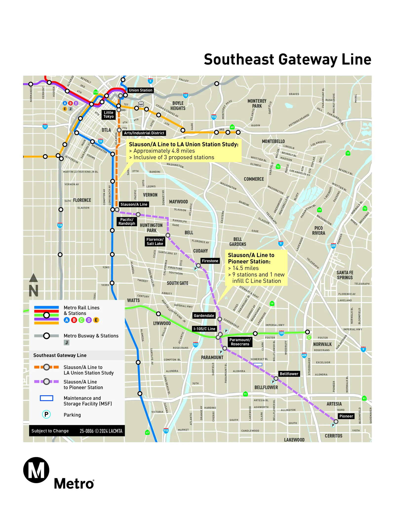
LA Metro’s updated Southeast Gateway Line map shows the 14.5-mile light rail segment from Slauson to Artesia alongside a roughly 4.8-mile downtown extension that remains a study.
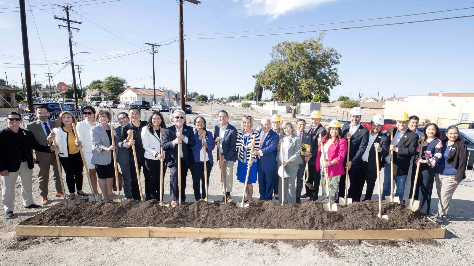
Nine stations on the Slauson–Pioneer segment
The updated project map, posted on metro.net in September 2026 and marked subject to change, labels Slauson/A Line, Pacific/Randolph, Florence/Salt Lake, Firestone, Gardendale, Paramount/Rosecrans, Bellflower and Pioneer along the southern segment, with an I-105/C Line label at the junction with the existing C Line. The map describes the segment as nine stations plus one new infill station on the C Line at the I-105 freeway.
Parking symbols appear at Firestone, I-105/C Line, Paramount/Rosecrans, Bellflower and Pioneer, and a maintenance and storage facility is drawn between Paramount/Rosecrans and Bellflower. On its project page, Metro lists up to five parking facilities and places the maintenance and storage facility in Bellflower.
| Item | Planned scope |
|---|---|
| Length | 14.5 miles of light rail |
| Stations | 9 (3 elevated, 6 at-grade) |
| Park-and-ride | 2,800 spaces in four surface lots and one parking structure |
| Street crossings | 30 at-grade, 15 elevated |
| Other crossings | 6 freight, 4 freeway, 3 river (flood control) |
| Maintenance and storage facility | 1 |
| New light rail vehicles | 29 |
Beyond the stations shown on the map, the Slauson–Pioneer segment includes 2,800 park-and-ride spaces and 29 new light rail vehicles. Source: Federal Transit Administration, Southeast Gateway Line project profile, last updated April 16, 2026.
The same map also shows the Eastside Transit Corridor Phase 2 to the east, with an initial operating segment to Montebello (Phase 2A) and a future extension to Whittier (Phase 2B).
The environmental review is complete. The Metro Board certified the Final EIS/EIR in April 2024, and the Federal Transit Administration issued its Record of Decision in August 2024, according to Metro’s June 2026 fact sheet. Metro secured $231 million in state funding through the Transit and Intercity Rail Capital Program in October 2024, and the project is now in design, with completion estimated for 2035.
Early work has started. Metro began advanced utility relocation in Artesia in October 2024 and in February 2025 awarded the advanced works construction manager/general contractor contract to Flatiron-Herzog. Its scope covers relocating utilities and freight tracks, installing grade crossings, and building bridges over the I-105 freeway and the C Line infill station.
Union Station link stays at study stage
North of Slauson, the map draws the route to Los Angeles Union Station as a study alignment of approximately 4.8 miles with three proposed stations. Metro staff presented the study findings to the Metro Board in May 2025.
Before work on that segment resumes, Metro staff will prioritize three tasks: securing a Full Funding Grant Agreement by 2027 for the Slauson–Pioneer segment, working with the City and County of Los Angeles to set up an Enhanced Infrastructure Financing District with dedicated funding for the Union Station segment, and completing preparations for the 2028 Olympic Games.